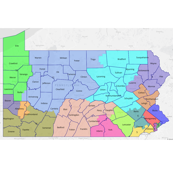
Three years ago, Draw the Lines PA held its first public mapping competition. 1,500 fully completed submissions later, as the General Assembly prepares to draw the Commonwealth's new congressional voting districts, we are proud to present the Pennsylvania Citizens' Map.
The Citizens' Map is a composite, 17-district congressional map that attempts to represent what over 7,200 Pennsylvanians have collectively mapped in five Draw the Lines competitions.
This map meets or exceeds the statistical benchmarks set by the 1,500 citizen maps, and it reflects the values that mappers declared as important to them. The Citizens' Map, in effect, represents the everyday Pennsylvania mapper.
This is the first such map that has ever been created by such a large group of citizens. It should be the starting point (or ending point!) for the General Assembly's work this fall. It should also inspire them to produce a preliminary map and narrative (The Story of the Citizens' Map) and publish it for public feedback before voting on a final plan.
Make sure to leave your comment on the Citizens' Map. What do you like about it? What would you change? Let us know!