State Champion, Youth: Kyle Hynes, State College Area HS
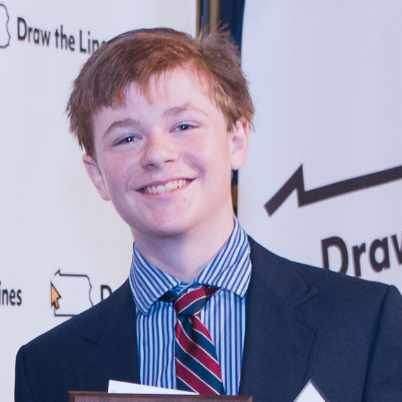
About Kyle Hynes: I'm a rising junior at State College Area High School in Centre County. I play on the soccer team, and am on the debate, math, quiz bowl, and Model UN teams as well. I am particularly interested in politics, and especially electoral reform. I volunteer for Fair Districts PA's Centre County chapter, and support using proportional representation to run our elections.
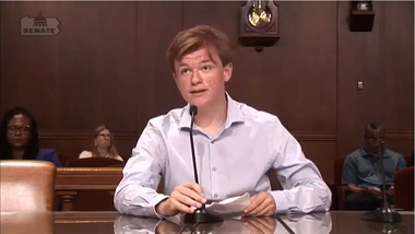
Kyle Hynes testifies in front of the Legislative Reapportionment Commission, Aug. 2021
Judges' statement
Kyle Hynes is a winner again. The statewide Youth champ in the first round of Draw The Lines has again taken the first prize in the Youth category in the Central region for what he calls his “Compact Map.”
He distinguished himself quantitatively by his superb scores on his stated goals of compactness, competitive elections and equal population, which are backed up by the “eye test.” This is a gorgeous map.
Kyle’s map was our unanimous choice for first place. We’d sum up his entry with this adjective: “incredible.” We are dazzled by Kyle’s mastery of the art and science of legislative mapping.
On top of his map, Kyle’s thoughtful, well-written and impassioned personal statement also is worthy of high praise, as is his extensive engagement around the issue, including testifying before the governor’s commission on redistricting reform. Kyle might be a perfect candidate to be a citizen representative on any redistricting panel formed under any legislative scheme.

Personal statement
Gerrymandering has always been one of the pains in our democracy - something that completely subverts everything that democracy is about. Millions of Pennsylvanians go to the polls every election and, although they get to darken a circle next to a candidate's name, it means absolutely nothing. Why is this? Because they've been forced into safe districts by gerrymandering.
Nearly every other country has managed to get around the gerrymander, one way or another. It's high time the United States, and in particular our home state of Pennsylvania, catches up. For my rendition of Pennsylvania's map, I put a lot of thought into what I wanted to prioritize, which I've outlined below.
Competitiveness is, to me, the single most important priority. Simply put, if people lives in a district where they are in a strong minority, their voice is quashed and simply doesn't count for anything at all. Safe districts also allow incumbents to sit back on their laurels, and to ignore the will of the people. This is also contrary to democracy.
The more that incumbents have to be true representatives, and have to fight for their seats, the stronger our democracy can be. The more voters that have a real say in the election of their representatives, the purer our democracy is.
For this reason, I tried to add as many competitive districts as I reasonably could. The final number I came to was 14 out of17, leaving three regrettably safe Democratic districts. Two are majority-minority districts that I left intentionally in the Philadelphia area, which I'll come to later.
The third is a Pittsburgh district that I fought endlessly to try to remove. I tried to spoke Pittsburgh to combine the urban, solid blue core of the city with rural areas outside of it. What I finally found was that to get that long-sought fifteenth district, I'd need to split the city of Pittsburgh into five districts, and create a long, ugly snake connecting Johnstown, State College, and Harrisburg. Ultimately, then, I settled for the safe district, drawing all of the suburban districts to be near-tossups.
Compactness is something that I also viewed as important. Maintaining communities of interest and similar areas within one district is, wherever possible, something to be strived for. I tried hard to make sure that this could be done while still keeping competitive districts, and I managed a Polsby-Popper compactness score of 45 percent.
I also made sure to maintain areas like the Delaware Valley and the Main Line wherever possible. However, this played, by necessity, second fiddle to competitiveness. Areas like the Lehigh Valley could have been kept together, but in the name of competitive districts, they had to be broken up. Counties, though, I completely ignored. These are arbitrary political boundaries that were, in most cases, drawn centuries ago and do not represent communities of interest in any way. Forcing a mapmaker to adhere to county lines can be a useful check on would-be gerrymanders, but when the aim starting out is to draw a fair map, it becomes apparent that splitting counties is completely fine.
For instance, where I live in Centre County, half of the county is in the 12th district, and half is in the 15th. The parts, though, are utterly distinct. The southern part, in the 12th, is the State College area, a small city, along with a few rural boroughs and townships. The northern part is nearly entirely rural and has more in common with nearby Clearfield County than with State College. So it doesn't bother me in the least that my county is split, not in the way that I would be if my town was split. So I tried to keep urban regions together, but often this, too, fell by the wayside in the quest for competitiveness.
In my map, I also wanted the population of each district to be roughly similar. This - the principle that every vote must count the same - is hugely important in a democracy. In my map, the population equivalence metric comes in at 1822, keeping all districts very close to the mean. Achieving this did mean decreasing the compactness metric a little bit.
Finally, majority-minority districts were imperative for me to retain. There is no provision in the Voting Rights Act that mandates a certain number of majority-nonwhite districts in each state, but it is generally understood that two is the magic number here in Pennsylvania.
One more competitive district probably could have been retained around the Philadelphia area had I removed one of the majority-minority districts, but that was not something I was willing to do. Why? The answer, to me, is simple. I would love to live in a society that had moved completely beyond racism. Theoretically, then, a 13 percent Hispanic district will have a 13 percent chance of electing a Hispanic to Congress. Yet that's not how it works. There is still racism in America, implicit or explicit, and maintaining two districts in which a racial minority could elect a candidate to represent their interests in Congress was imperative to me.
Unfortunately, when drawing these maps, something has to give. Something has to be sacrificed. One could draw long, stringy, spindly districts traversing the state, all competitive (or all but one), but this would split up communities. One could draw perfectly compact districts, but that would strip many people of their democratic right to have a meaningful vote in a competitive election. One could draw districts with no differential in populations, but to do this using census tracts would require weird, awful convoluted shapes that would be neither competitive nor compact.
Or one could draw a map like mine, a wholly imperfect compromise among the ideas, where most people have a true say, most live in a compact district, and everyone's vote is roughly equal. There is no way to achieve perfectly all of these goals simultaneously.
Or is there?
There is a system that achieves all of these goals, one in use in most major democracies worldwide. Proportional representation systems ensure that the result in the legislature is proportional to the votes cast, as it should be (to quote John Adams, the House should be “a perfect portrait of the people”) but that every vote is important and has a true influence in the election. It allows everyone to vote for local candidates if they want, ensuring communities of interest can vote together. Third parties can win seats for the first time, as they will no longer be dismissed as “spoilers” running against the traditional Democratic/Republican dichotomy, but rather candidates who, thanks to the proportional system, have a real chance of being elected. And every vote would be equal at long last.
Single transferable vote is a system where voters, in larger districts (Pennsylvania might be divided into four, with four or five representatives each), rank the candidates on their ballot paper, and through a somewhat complex system that can't be explained here, it produces a proportional result by party, and allows a more representative House, all while maintaining the important principle that every vote is equal and meaningful. I implore everyone to at least consider supporting replacing our old, outdated system “where everything depends on how we draw the lines“ with a system that has been proven to work.
In sum, what I have to say is this: It's supremely important that our politicians learn that normal people have the power to draw these election maps. It's supremely important that we wrench the pen from their hands and begin to draw the lines ourselves. But the true path to electoral reform is not to change the way we draw the lines, although that is a monumental first step. The true path to reform is to erase the lines."