Completing your first map
Completing a good map
- Maps usually take between 3-6 total hours. We suggest drawing in several, shorter sessions. Your work automatically saves, so you can return to it later.
- Use a geographical pattern when creating districts, EG: work your way from east to west or south to north
- Make sure you create 17 districts
- For your first map, make a rough map at the county level, where districts are close to the target population but not exact. You'll fine-tune later.
- To finish, each of the 17 districts must have a population between 743,463 and 750,935 (this is +/- 0.5% of the target population number)
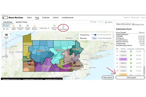
- Check frequently whether you have left small areas unassigned. To do this, click on the "Unassigned" category at the bottom of the stats table (on right). A blue outline will appear around unassigned areas. You may have to zoom in to see them.
- If you're mostly finished, you can let the software assign any unassigned district. To do this, click the "Fixed Unassigned" and unassigned areas will be added to the nearest districts. (Warning, this may throw off your population balance.)
